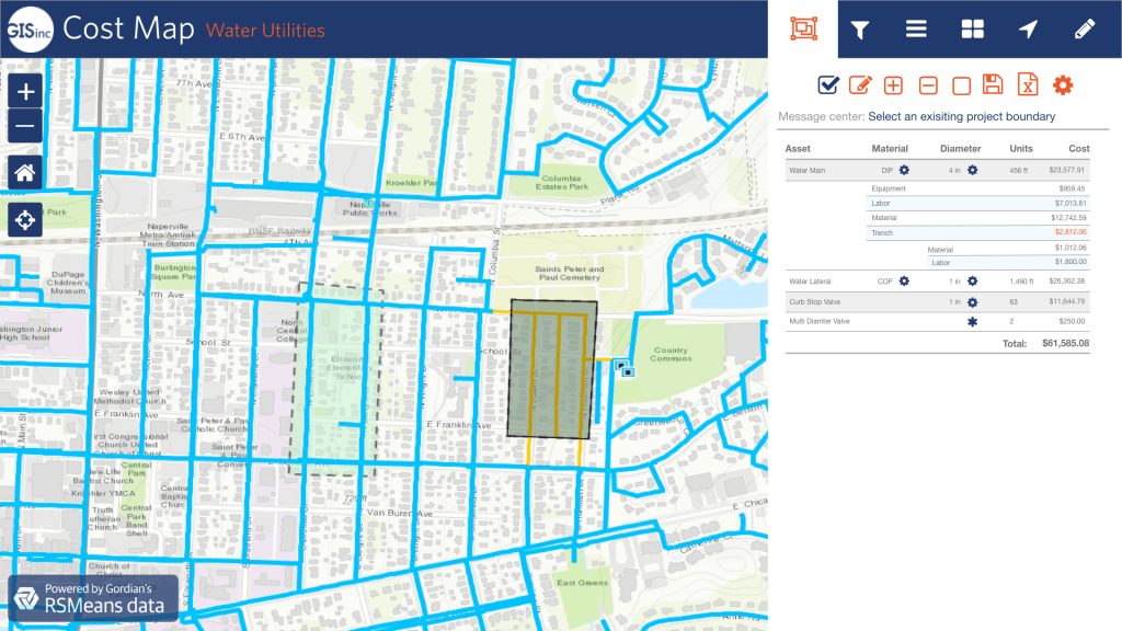
Cost Map, a web-based solution, integrates RSMeans data from Gordian API with the ArcGIS Platform from Esri. By mapping RSMeans data to Esri’s Data Utility Model, Cost Map provides a quick and reliable construction cost estimation process.
Value to Water Utilities
- Data is mapped to Esri’s Data Utility Model
- Compare present vs future cost estimates to prioritize resource allocation
- Validate project estimates and compare various vendor data
- Access dependable, up-to-date and local construction cost data through RSMeans data API
- Increase cost accuracy with regionalized construction labor rates