


LaDOTD
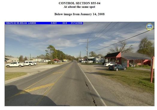
That same section of road three years later. Note asphalt cracki…
Building the foundation
Long before the Moving Ahead for Progress in the 21st Century Act (MAP-21) required states to provide a linear reference system (LRS) for public roads, the agency was harnessing condition data for state and federal roads. The LRS maps roadside inventory and assets such as streetlights and signs in relation to the highway.
Since 1995, the agency has retained Fugro Roadware, an asset-management solutions provider based in Mississauga, Ontario, Canada, to collect values for condition indicators such as cracking, patching, roughness, rutting, and surface texture, as well as right-of-way (ROW) photolog.
Fugro collects data via Automatic Road Analyzer (ARAN) vehicles that can measure more than 15 data streams continuously in a single pass at traffic speeds. Clients can buy and use one of three models or, like LaDOTD, contract with Fugro on a mileage-collected basis.
All 35,800 miles of state routes are assessed every other year; 5,700 National Highway System miles in Louisiana are assessed annually. Data from the nine LaDOTD districts is housed in a central database called the Pavement Management System (PMS).
In addition to aggregating the data into an overall condition score, the agency has an index for each distress value. Quality control and quality assurance (QC/QA) standards ensured consistent data entry, and district employees were sharing analyses with headquarters via Fugro’s reporting software, called Vision, and iVision web-based viewing software.
By 2005, the agency was using the data to evaluate, plan, cost, and design maintenance interventions.
“It drives our analyses, ensuring we’re optimizing project selection by doing the right treatment at the right time,” says pavement management engineer Christophe Fillastre. “It helps to justify preservation over ‘worst first’ projects.”
So when the hurricanes hit that year, the agency already had extremely accurate condition benchmarks and historical deterioration rates. These provided the baseline for evaluating the damage and justifying both short- and long-term funding requests.
Once flooding receded, gathering current condition data became the priority.
Next page: GPR-enhanced supplemental data