


LaDOTD
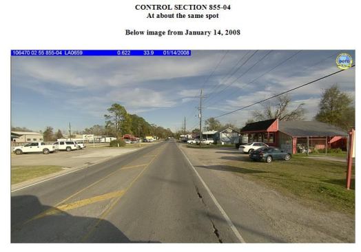
That same section of road three years later. Note asphalt cracki…
GPR-enhanced risk modelling
While GPR helped to plan repairs, it was being combined with road geometry data and other condition data to mitigate future risk.
“To manage evacuation more efficiently, we wanted elevation data to assess which areas are likely to flood first,” says Chapman from the agency’s Data Collection & Management Systems group. “That data also helps the districts understand what sections may need to be raised and watch for potential issues such as subsidence.”
The thinking ties in with the agency’s overall post-Katrina goal to have better visibility of state highways to improve emergency response. This led to implementing centralized traffic control that gives drivers live information on highways and diversion routes.
“GPR improves our modelling,” Chapman says. “We can look at the curves, forecast maintenance, and spot changes with or without a catastrophic event.”
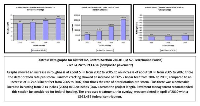
The agency reviews deterioration curves every 18 months to create a new project list. Headquarters recommends projects backed by data that would justify funding requests, but district engineers make their own choices.
Having a deterioration index means engineers can spot deviations in patterns and validate the need for intervention before problems require more serious treatment.
GPR also helps with replacement projects.“We can pull up the GPR data, cross-reference the relevant core, and use them for design and construction,” says Fillastre. GPR is now a standard item in the agency’s Fugro contract. Data is collected every six to 10 years.
Next page: Ensuring accuracy